Phoenix Sky Harbor International Airport (PHX)
Driving Directions / Travel by Car
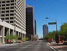
(Phoenix, Arizona - AZ, USA)
Standing alongside the northern banks of the Salt River, Phoenix Sky Harbor International Airport (PHX) is situated less than ten minutes south of downtown Phoenix. A number of prominent highways and interstates surround Sky Harbor Airport and include the I-10 interstate (Papago Freeway / Maricopa Freeway) to the west, and both the AZ-153 and AZ-143 (Hohokam Expressway) to the east.
On the northern side of Phoenix Airport you will find East Washington Street and East Van Buren Street, both of which run in an east-west direction, parallel with the AZ-202 (Red Mountain Freeway). Access to the terminal buildings can be made from either the east or west, along the East Sky Harbor Boulevard.
Directions to Phoenix International Airport (PHX) from the downtown district:
- Travel towards Sky Harbor International from downtown Phoenix
- Take 7th Street and head in a southerly direction
- Take the I-10 interstate and head east
- From north and the city, take the AZ-51 highway in a southerly direction and continue along the I-10 interstate
- From Glendale, Peoria and Sun City West, take the AZ-101 and continue along the I-10
Directions to Phoenix International Airport (PHX) from the north
- When traveling from Northeast Phoenix, Scottsdale and Paradise Valley, take the AZ-202 or AZ-153 highway and head in a southerly direction
- When traveling from Flagstaff, take the I-17 interstate (Arizona Veterans Memorial Highway / Black Canyon Highway) and head in a southerly direction and join the I-10 interstate
- Follow the airport sign posts, and turn into the Phoenix Airport
Directions to Phoenix International Airport (PHX) from other cities
- When traveling from Gilbert, Mesa and Tempe, take the US-60 or AZ-101 and head north
- Continue along the AZ-202 highway in a western direction and exit at the Sky Harbor Boulevard
- When traveling from Chandler and Tucson, take the I-10 interstate and travel in a westerly direction
- Head towards Hohokam Expressway AZ-143 and continue along University Drive
- Travel along the AZ-153 and continue to the Sky Harbor Boulevard west
Phoenix Sky Harbor International Airport (PHX): Virtual Google Maps
